|
Hiking Group |
 |
Return to hiking home page |
Copyright © 2000-2002 by Michael Wimble, ALL RIGHTS RESERVED |
Sanborn Park
The announcement:
Back to Sunday again, after a lot of Saturdays. We'll be doing a hike AND a picnic again. This week we're going to try some place we've never been. So, Sunday, picnic, new place, and men with maps -- sounds like the recipe for a disaster -- well, at least a chance for an adventure.
The new place is Sanborn Park, just a couple of miles outside of Saratoga. Kathy and I drove to the parking lot Monday and picked up a map, and saw a couple of fawns along the way. The maps makes it look like we'll be doing a lot of climbing. We'll just go along until we feel like turning back.
The hike:
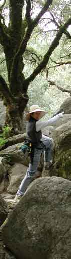
The hike was a hoot. The maps for the park were a bit difficult to interpret. As is so often the case, park maps seem to represent complicated tracks as a squiggley line. Mind, the line has little relationship to the real trail. I suppose it's supposed to be like the "curves ahead" traffic signal. But, when you're trying to figure out how far you are along the trail, and the map says there are three bends and you've just gone through five bends, it gets pretty irritating.
At one point, three of us were absolutely sure where we were, especially me, and each of us was sure were were in a different place. This just reinforces the running joke in the group that there are few things as dangerous as men with maps.
For those who stayed afterwards, we had our first geocache hunt. We failed! We'll have to see if there isn't a geocache near this hike.