|
Hiking Group |
 |
Return to hiking home page |
Copyright © 2000-2002 by Michael Wimble, ALL RIGHTS RESERVED |
Portola Redwoods State Park
This was the last waterfall hike of the season, other than two that we may take later in the year (as they run later than most streams in the Bay Area). Since it was a long, twisty drive to the park, we also had a picnic afterwards. This was our third attempt at doing this hike this year. The first was rained out. The second was changed at the last minute to a hike of Montebello Ridge.
The nine of us stopped into the park headquarters to start. A couple of us bought a book on flowers in the area, as they are one of the few places that actually stock the book. A few bought maps of the park, and Michael got directions to Tiptoe falls. Michael has hiked the area several times and had yet to get to the falls.
The bridges are actually removed from the streams during the rainy season so that they won't get washed away, and they aren't placed back until May. So seeing Tiptoe falls involves wading a stream. The last time we tried to find the falls, all the trails were closed and Peters Creek was too high to wade.
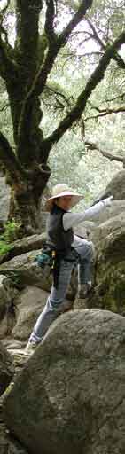
This time, we weren't sure we were going to be able to cross again. Dirk was the first to find a crossing point, but only Steve was willing to follow, and the water went over the top of his shoes. Michael found another crossing, but it involved quite a balancing act on wet, slippery rocks, and the use of a long balancing pole to make the last jump. But, everyone who wanted to managed to make it across the creek.
A short search found a marker pointing the way to the falls. A short hike brought us to a fall with an 8 inch drop (see the gallery of pictures). We all hoped that wasn't the real falls. But, a few yards further showed the real falls. There was actually yet another fall just a short distance further, but it wasn't practical to get to. Tiptoe falls has tall, steep sides coming down to the creek, making getting up further nearly impossible without going back and finding another path around the mountain.
Dirk again, on the way back from the falls, braved his own path across the stream, while most of the rest of us simply went back the way we came, which was an adventure in itself.
We then intended to take the Slate Creek/Summit Trail loop and then have a picnic. Unfortunately, doing this loop clockwise has always eluded us -- we can never find where Slate Creek joins up near the camping area. By the time it was obvious that we had missed the cutoff, Steve suggested that we take a new trail instead, up Coyote Ridge trail. And thus began the Great Mountain Climb March of March.
As happens almost every time we take a trip that we haven't tried before, the trail turns out to be longer or harder than we anticipated. This time, it seemed that we just kept climbing and climbing without end. It was actually only a bit over 700 feet of climb, but it seemed longer. Fortunately, the wildflowers were just starting to bloom. Oh, and the forest was stunning. But at this time of the year, all the trails are beautiful.
About the time that a mass mutiny was being planned, we reached the ridge top. Then we climbed a bit more and reached the ridge top. Then, after a bit more climbing, we reached the ridge top. Eventually, of course, we finally did reach the real ridge top. After a short rest, the hike down was short and fast.
The picnic was fun, possibly helped a bit by Ted's wine that he shared. We played our own version of the "Tabboo" game for almost an hour, and then we headed back.
A couple of people were a bit sore the next day. And one person though he lost his keys along the trail. Of course, the only place he could have lost them was at the very top of the ridge. But, it turned out to be a false alarm.
All in all, a perfect hike. A water adventure, a challenge with a great sense of accomplishement, a picnic, lots of humor, a brief panic -- what more could you ask for?
For the gallery of pictures from the hike, click HERE.
Note that the bridges are not put in place during the rainy season, so Tiptoe falls requires wading a stream unless you wait until May. This park is located off from Alpine Road, on the ocean side of the Santa Cruz mountains. There are a wide range of hiking options, from the easy to the rather hard. The shorter trails are well travelled and well groomed. At least one of the longer trails seems to be infrequently groomed and heavily overgrown with poison oak.Directions
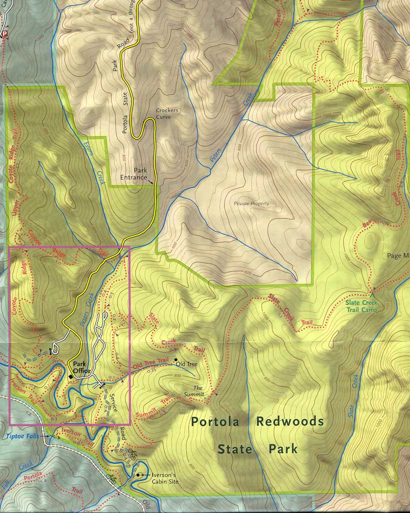
Click on the map below for a larger, higher quality map.
See also