Uvas Canyon County Park
Description
This is a medium length hike, with a fair amount of climbing. But, half the climbing is along beautiful streams with waterfall after waterfall. There is a little over 1000 feet of climb along the first stream, and 200 feet along the second stream.
The trail is completely covered except for a little over a half mile near the end. The trails along the stream beds are more or less clear of poison oak, but you need to pay attention. Between the streams, the poison oak encroaches a lot more. It's easy to avoid, but you need to watch where you walk. There are several bridges over the first stream, with enough photo opportunities to go through more than one roll of film. The streams do disappear after the spring, so go early while it's still cool.
This trail is moderate to hard on the "Wimble Scale". Plan on two large water bottles and one or two snacks. The hike will take 2 to 3 hours. There are facilities at the trail head.
Directions
- Take Highway 101 South from San Jose to Morgan Hill. Take the Tennant Avenue exit and head west.
- As you enter Morgan Hill, take a left onto the Monterey Highway—the main road through town—head south for a short distance to Watsonville Road.
- Take a right on Watsonville Road, heading west again. As you leave town, there is usually a soft fruit vendor off to the side of the highway. This is a good place to get cherries or strawberries for a hiking snack.
- A couple of miles or so down the road, you'll pass a small collection of houses on your right, with Sycamore Drive passing off to the right through those houses. You could take this road, but get a map if you do. Instead, the easy way is to go just a short distance further along Watsonville Road to where Uvas Road intersects on your right. At this intersection, there is a dirt parking area on the left, which usually contains one or more cars for bicyclists parked there. There is also a winery located just shortly down Uvas Road.
- Turn right onto Uvas Road. A short distance, this road will veer left, just stay on the road as it takes you past the Uvas Reservoir, heading northwest.
- A mile or so beyond the reservoir, you should see a sign on your left for the Uvas Canyon County Park. Turn left onto Croy Road and head west.
- Croy Road meanders and climbs for nearly 5 miles until you enter a private resort, Sveadal,, which belongs to the Swedish American Patriotic League. Pass through Sveadal a short distance until you enter the Uvas Canyon County Park.
- Pay $5 to park at the parking lot. There is an automatic ticket machine, which even accepts credit cards. Pick up a map.
- Head northwest towards the amphitheater. There you will find toilet facilities. Follow the trail and you will come back out to a paved road.
- Follow the signs beyond the next parking lot, which lead you down and to the right to the Waterfall Loop. This begins with a short descent down to the Swanson Creek.
- At the trail head, there is a wooden bridge. Begin the ascent of the Waterfall Loop.
- At a little less than a half mile along the trail, there is a cutoff which will take you back to where you began, completing the loop. This is the short hike option. For the longer option, continue west along the trail.
- There is a short diversion to the right, heading north for a short distance to Black Rock Falls, if you wish. Then return to the trail.
- About a quarter mile further, there is another short diversion to Basin Falls. Return to the trail afterwards.
- About a tenth of a mile beyond the very picturesque Upper Falls, you will cross Swanson Creek. This is near the summit of the hike. Begin the relatively flat hike back towards the trail head.
- This flat portion is where you will have to be most attentive for poison oak. There should be a fair number of deer bounding about, and there may be quite a few wildflowers, so paying attention to the trail takes concentration.
- Less than a mile and a half beyond the cross over of Swanson Creek, you'll come to the Alec Canyon road. You can head left here and return to the trailhead for a moderate hike, or take a right towards another set of water falls.
- About half a mile to the right along Alec Canyon, you'll come to the short trail leading to Triple Falls. This is a quarter mile hike up about 200 feet to the trail end.
- Return from Triple Falls to Alec Canyon and bear left back towards the trailhead.
- At the intersection with the trail you came from on your left, bear right and remain on Alec Canyon.
- About a quarter mile beyond the intersection, you will begin a short, steep descent back to the trailhead and Park Headquarters.
Flowers
- [Many—to be filled in yet]
See also
Trip Reports
Saturday, May 20, 2000
Nancy, Kathy, and Mike attempt to see nearly all the falls before they dry up in the summer.
Click on pictures below to view 1024 x 768 versions (approximately 1 MB in size).
|
|
|
|
|
|
 |
|
|
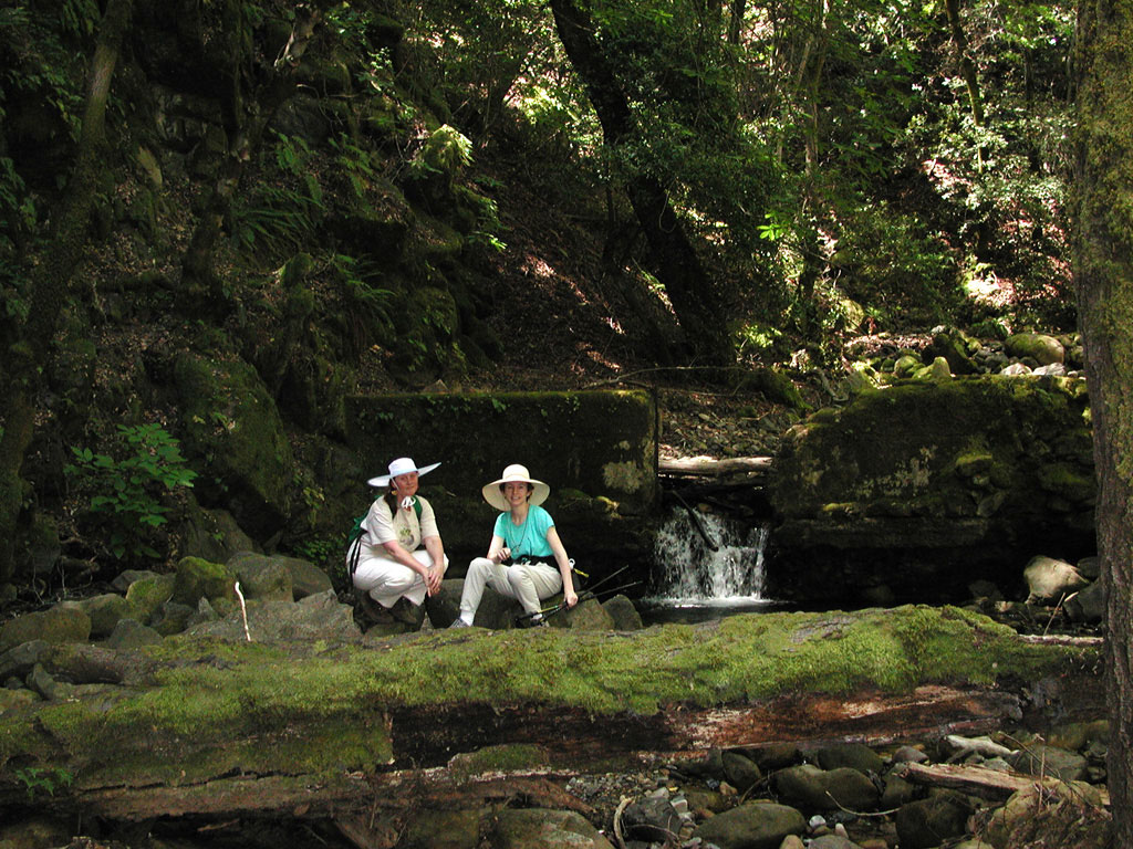
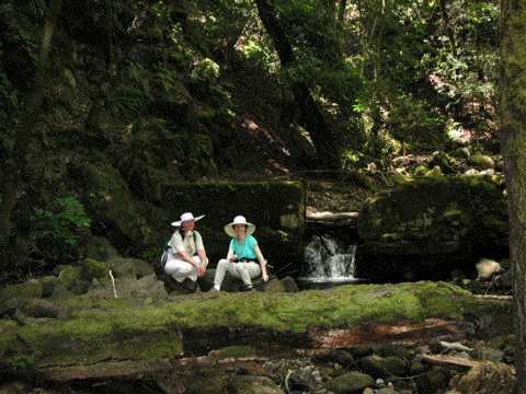
Nancy and Kathy seated near one of the lesser falls. |
|
|
|
 |
|
|
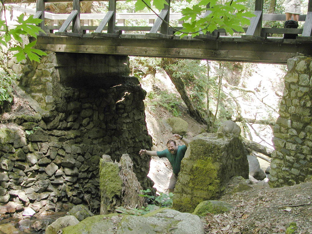
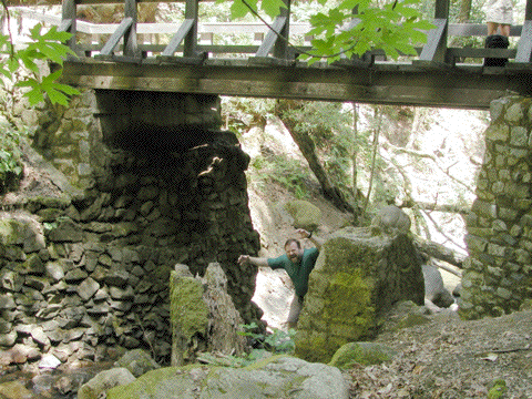
The infamous troll that lives under the bridge. Be afraid. Be very afraid. |
|
|
|
 |
|
|
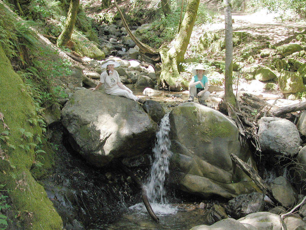
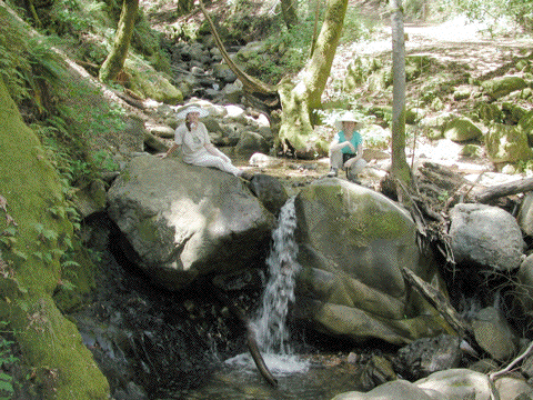
Nancy and Kathy at one of the more picturesque falls. |
|
|
|
 |
|
|
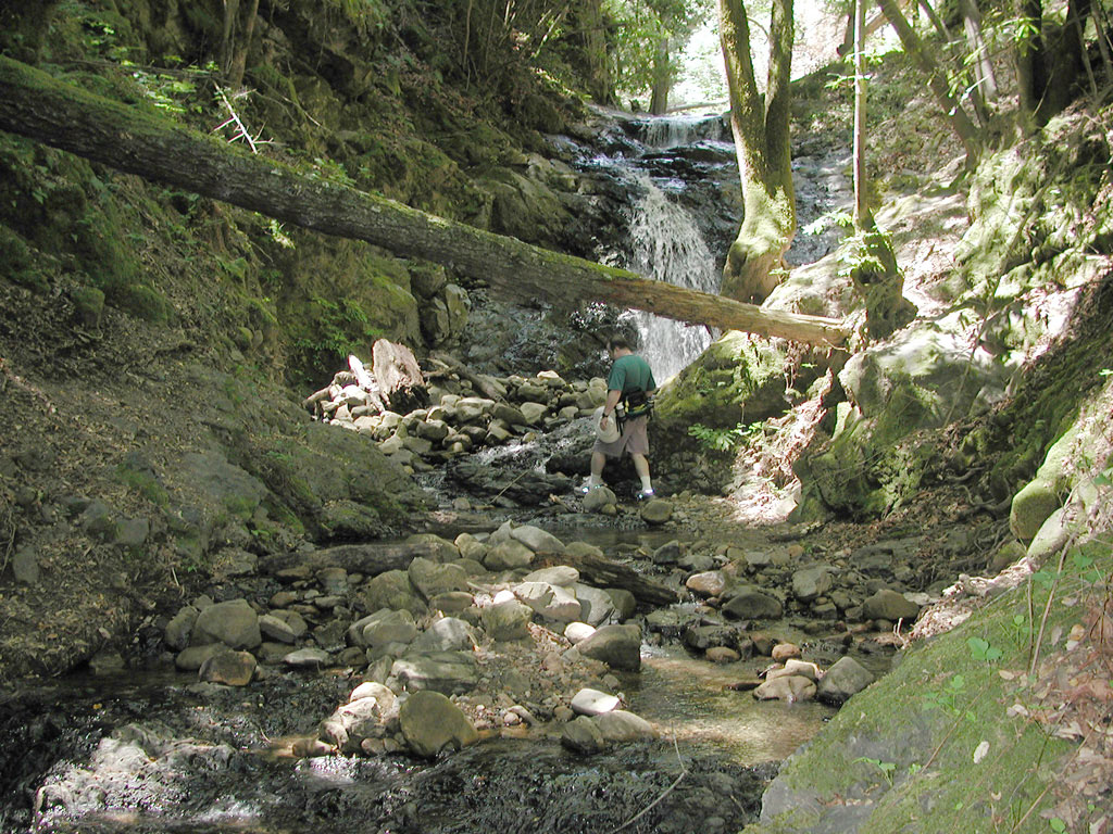
Michael at Upper Falls. |
|
|
|
Copyright © 2000-2002 by Michael Wimble, ALL RIGHTS RESERVED